
The Best Hiking Trails in Wind River Range
Explore Hiking TrailsTop 11 hiking trails in Wind River Range
1


Lake Louise
Tucked away in Fitzpatrick Wilderness, Lake Louise offers an easy day hike to one of the Wind River's stunning glacial lakes. Along the way, you'll even pass a massive waterfall cascading through the canyon, runoff from the lake itself....
2


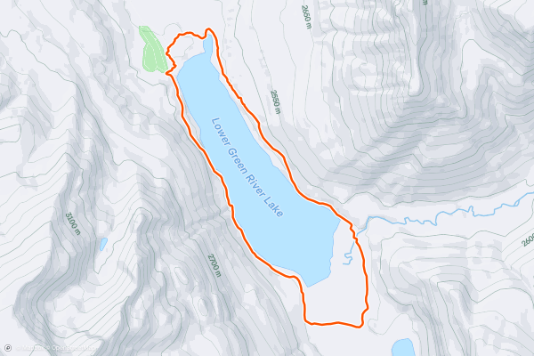
Lower Green River Lake Loop
Just 6 miles total, this easy day hike circumnavigates one of the Wind's many spectacular glacial lakes. In addition to an abundance of backcountry hikes in the area, canoeing, kayaking, and even paddleboarding are also popular on Lower Green River Lake....
3
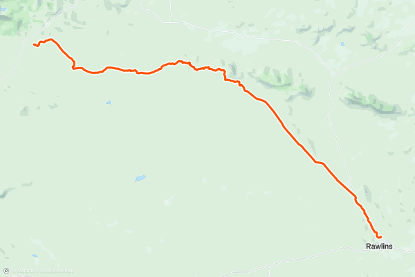
CDT: Rawlins (US-287) to South Pass City (WY-28)
This section of the CDT begins at a small pull-out on US-287 north of Rawlins. Neither water nor restrooms are immediately available, though the small town is noted as a key resupply point for thru-hikers....
4


Cirque of the Towers
Described is the shortest route into the Cirque of the Towers: In and out via Big Sandy Trail. The loop with Texas Pass is mentioned, but not detailed.
The trail starts out mellow, on a level ground among conifer forest beside the Big Sandy River....
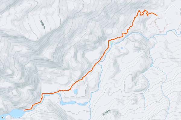
5


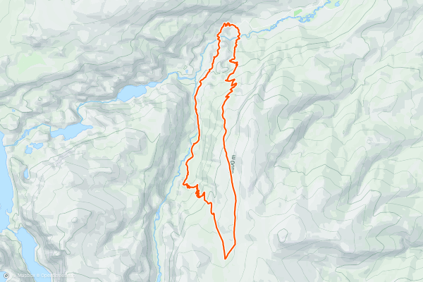
Glacier Trail Loop
Located in the Fitzpatrick Wilderness portion of the Wind River Range, this backcountry loop is great as a day hike, overnight trip, and perfect for trail runners. Enjoy stunning mountainside views, a beautiful waterfall, summer wildflowers, but know that this loop requires a river ford at the beginning (or end) of the trip....
6


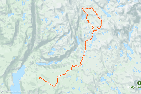
Seneca and Lost Lakes
Though [Titcomb Basin](https://fatmap.com/routeid/519710/Titcomb_Basin/@43.0854631,-109.7097362,42297.9121674,-52.4743586,0,3237.0219725,normal) is one of the most highly-acclaimed backpacking routes in the Winds, this route should be considered a close second. Located along same path to Titcomb Basin, this loop spurs off onto the [Continental Divide Trail](https://fatmap....
7


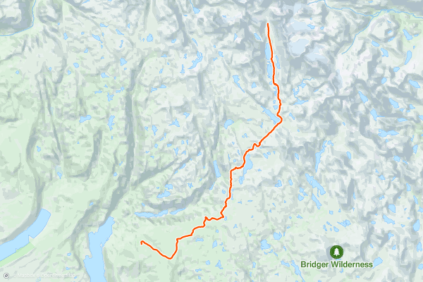
Titcomb Basin
Along with [Cirque of the Towers](https://fatmap.com/routeid/30990/Cirque_of_the_Towers), Titcomb Basin is one of the most coveted areas anywhere in the Winds. This backcountry route is best as a multi-day backpacking trip, though seasoned trail runners often make their way to the basin and back in a single day....
8

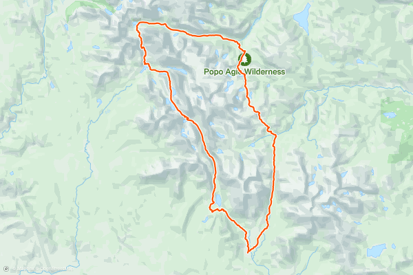
Sweetwater Loop
While [Titcomb Basin](https://fatmap.com/routeid/509625/titcomb-basin/@42.7122734,-109.2741561,112154.7357279,-90,-0.1749419,2899.1397889,normal) tops the list of epic 3-5-day backpacking trips in the Winds, the Sweetwater Loop is equally as epic and includes the infamous [Cirque of the Towers](https://fatmap.com/routeid/30990/Cirque_of_the_Towers/@42.7122734,-109.2741561,112154.7357279,-90,-0.1749419,2899.1397889,normal), a "high alpine basin rimmed by huge granite spires," according to Jesse Weber....
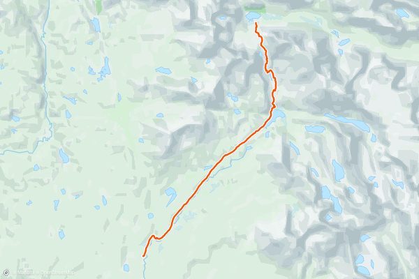
9

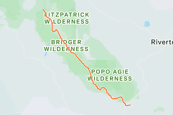
CDT: South Pass City (WY-28) to Green River Lakes CG
This is perhaps the most stunning and beautiful section of the Continental Divide Trail, at least in Wyoming. Considered by many as the wildest and most rugged mountain range in the lower 48, the *Winds* are by far one of the most coveted sections of the entire CDT....
10


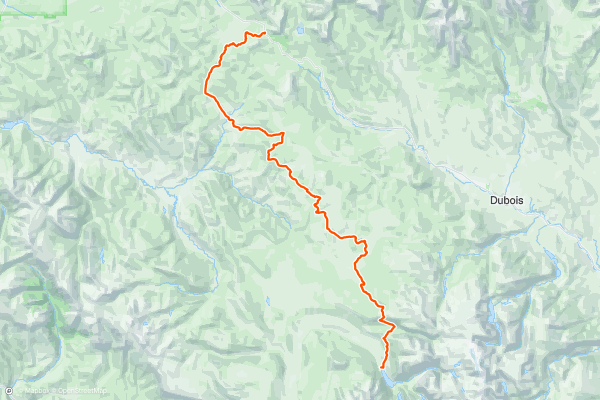
CDT: Green River Lakes CG to Togwotee Pass (US-26)
This leg of the CDT rounds out one of the most spectacular and stunning sections of the entire 3,100-mile footpath. Those seeking a multi-day section hike may enjoy [this segment](https://fatmap.com/routeid/2803678/cdt:-south-pass-city-(wy-28)-to-green-river-lakes-cg) to the south, while those traveling to Yellowstone or the Tetons will enjoy easy access to this segment from Togwotee Pass....
11


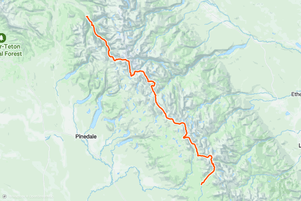
Wind River High Route
The Wind River High Route is one of the most coveted backcountry adventures in the west, and for good reason. [This](http://blog.ultimatedirection.com/wind-river-high-route/) blog published by ultimatedirection.com suggests the Winds are "..the most wild and remote range in the Lower 48," with the High Route running along the spine of the mountains....
Top regions for hiking trails on Strava
- Acadia National Park
- Alabama
- Alaska
- Albuquerque
- Alyeska
- Angeles National Forest
- Arizona
- Arkansas
- Austin, TX
- Bay Area
- Bend
- Big Sky
- Blue Mountain Ski Area
- Boston
- Boulder, CO
- Brevard
- Bridger Bowl
- Buena Vista
- California
- Cape Cod
- Colorado
- Connecticut
- Dahlonega
- Downieville
- Ellijay
- Flagstaff
- Florida
- Georgia
- Glacier National Park (USA)
- Grand Teton National Park
- Great Smoky Mountains National Park, TN
- Hawaii
- Hurricane
- Hyalite
- Idaho
- Illinois
- Indiana
- Kansas
- Kentucky
- Lake Tahoe
- Las Vegas, NV
- Los Angeles, CA
- Maine
- Mammoth Mountain
- Marin County
- Maryland
- Massachusetts
- Maui, HI
- Michigan
- Minnesota
- Missouri
- Moab
- Montana
- Mount Rainier National Park
- Mt. Rainier National Park, WA
- Nederland
- Nevada
- New Hampshire
- New Jersey
- New Mexico
- New York
- New York, NY
- North Bridgers
- North Carolina
- North Dakota
- Oakridge
- Ohio
- Oklahoma
- Oregon
- Park City and Deer Valley
- Pennsylvania
- Phoenix, AZ
- Placitas
- Portland, OR
- Roanoke
- Salida
- Salt Lake City, UT
- San Diego, CA
- San Francisco, CA
- Santa Fe, NM
- Santa Monica Mountains
- Seattle, WA
- Sedona, AZ
- Sisters
- South Carolina
- South Dakota
- South Lake Tahoe, CA
- Stowe
- Sugarbush
- Sun Valley
- Taos
- Telluride
- Tennessee
- Texas
- Timberline Lodge Summer
- Utah
- Vermont
- Virginia
- Washington
- West Virginia
- Wind River Range
- Winter Park
- Wisconsin
- Wyoming
- Yellowstone National Park
- Yosemite National Park, CA
- Zion National Park, UT