
The Best Hiking Trails in North Carolina
Explore Hiking TrailsTop 99 hiking trails in North Carolina
Page 1 of 5
1
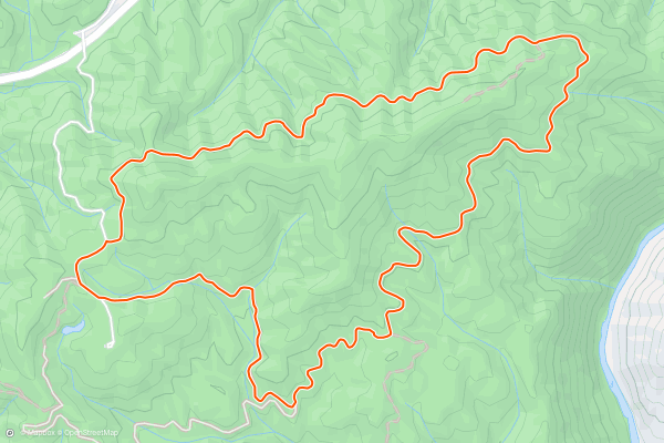
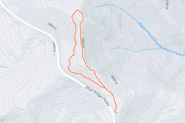
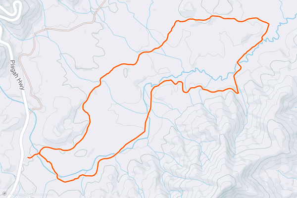
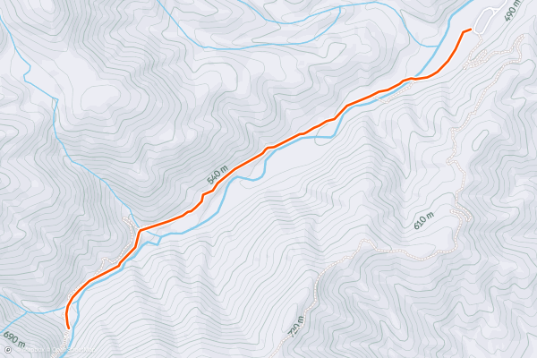
Mill Ridge Trail
Pack a lunch and bring the entire family on this scenic hike near Hot Springs, NC. According to Wikipedia, the natural hot spring the town is named for is the only one of its kind in North Carolina, and in most of the southeastern United States....
2

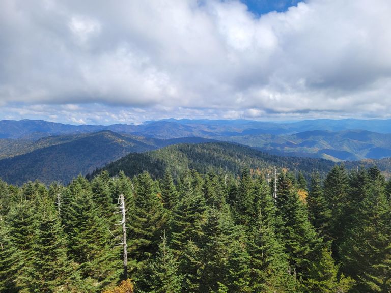


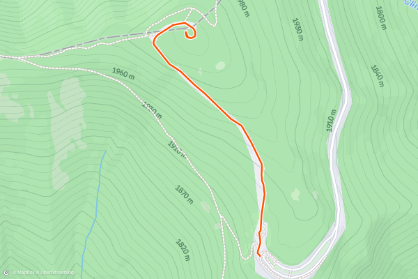
Clingmans Dome
Clingmans Dome is the highest point in Great Smoky Mountains National Park and the third tallest mountain east of the Mississippi. It’s summit is 6,643 feet above sea level, but not hard to reach thanks to a road and paved trail that leads to an observation tower If you want an epic view without epic effort to reach it, Clingmans Dome is for you....
3


Mount Mitchell Summit Trail
Towering at nearly 6,700' above sea level, Mount Mitchell is a hiker's paradise and the highest peak east of the Mississippi River. The infamous Black Mountain Crest Trail, the High Loop, and North Carolina's 1200-mile long Mountains to Sea Trail all provide incredible hiking experiences within the state park....
4


Richland Balsam Summit Loop
Hike through dark spruce-fir forests on this well-marked summit hike to the highest of the Great Balsam Mountains. Less than 1.5 miles round trip, the loop climbs along a ridge, summits the peak, then skirts around its western edge back to the parking lot....
5


Wiseman's View
Wiseman's View is one of the most renowned vistas in Linville Gorge. It's less of a hike and more of a short walk, and it awards spectacular views of Linville Gorge....
6


Silver Run Falls
Silver Run Falls is a short waterfall hike just minutes from High Hampton Resort and great for anyone visiting Cashiers. Below the falls, there is a massive swimming hole that can become quite crowded in the summer....
7
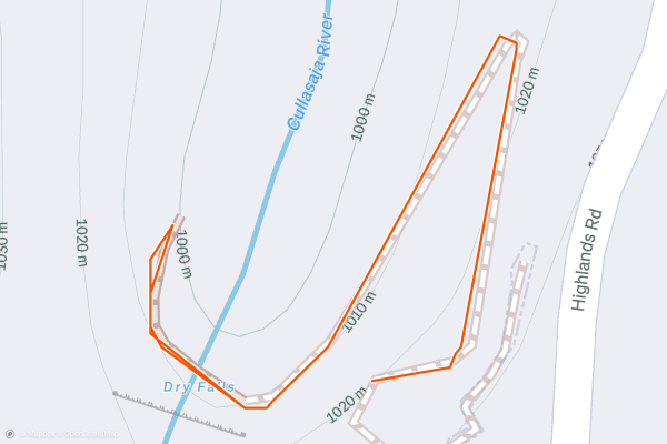
Dry Falls
Dry Falls is a breathtaking waterfall in Nantahala National Forest and a great short hike for anyone visiting Franklin or Highlands, North Carolina. The trailhead is located along Highway 106, a paved two-lane road through the Cullasaja Gorge....
8


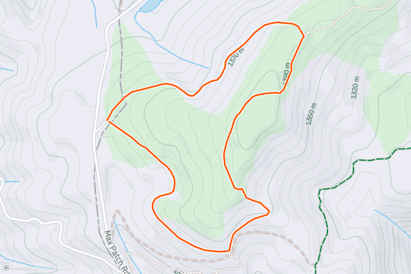
Max Patch
Max Patch is one of the most iconic and recognized peaks along the 2,200-mile-long Appalachian Trail. It's located between [Davenport Gap and Hot Springs](https://fatmap.com/routeid/40012/appalachian-trail:-davenport-gap-to-hot-springs), and this easy 1.5-mile loop is well-marked and great for any member of the family - including the dog!
According to an article in "The Mountaineer," "this amazing area was cleared and used historically as a pasture for cattle and sheep back in the 1800s....
9
Picklesimer Rock House Falls
Picklesimer Rock House Falls is one of the best-hidden gem waterfalls in Western North Carolina, and a hike everyone in the family will enjoy. It's rather short, following old logging roads into a beautiful grassy meadow painted with spring and summer wildflowers, then meanders on to the waterfall, which can usually be heard before seen....
10
Sugar Creek Falls
Sugar Creek Falls is a short waterfall hike in Caney Fork that will leave you wondering how many more waterfalls are nearby that you have never heard of. Well, the answer to that question, is *several*, according to local guide company [White Dot Adventures](https://www....
11


Douglas Falls
Douglas Falls is a stunning 70-foot waterfall at the very top of Big Ivy Road, made even better thanks to the numerous roadside waterfalls you'll encounter on your drive up. Camping and bouldering/rock climbing are abundant along the unpaved drive there, and "while the water flow is usually on the low side, it's a beautiful setting and an easy hike" about 45-minutes from Asheville....
12


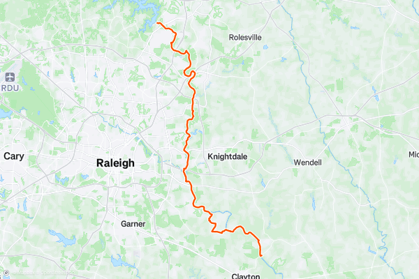
Neuse River Trail
The Neuse River Trail is a lengthy paved greenway trail running through the Raleigh/Durham metro area. This trail is extremely popular with road cyclists (both recreationally and for commuting), but walkers/hikers, runners, skaters, and more all use this trail....
13


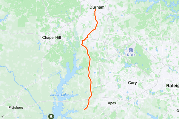
American Tobacco Trail
The American Tobacco Trail is a 22.6-mile rail-trail that runs through three counties in North Carolina: Durham, Chatham, and Wake. The trail follows the former railroad corridor of the American Tobacco Company, which was built in the 1970s and abandoned in the 1980s....
14
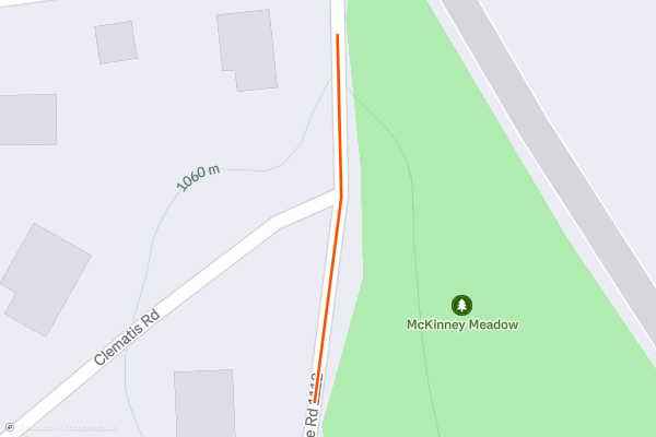
McKinney Meadow
McKinney Meadow is a small mountain meadow just minutes from the crossroads in Cashiers. Open year-round, you find an array of native wildflowers, pollinators, and plenty more. Whether you're just passing through town, or planning a visit to Cashiers, make sure to add this to your list during your next stay....
15


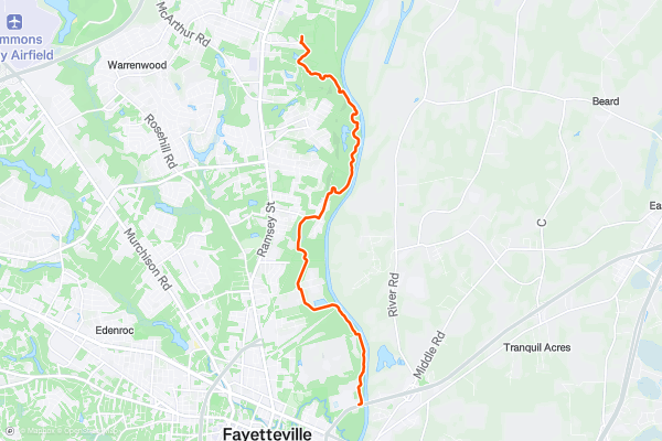
Cape Fear River Trail
Stretching approximately 5.3 miles through Fayetteville, the Cape Fear River Trail offers a serene pathway for walking, jogging, cycling, and wildlife observation. The trailhead is easily accessible from several points, including the Jordan Soccer Complex and Clark Park Nature Center, so you can either do it as an out-and-back (as drawn here) or just pick sections of it....
16

Pink Beds Loop
With little elevation change, this well-marked loop is one of the best hikes in Pisgah National Forest. Pack a lunch and bring your dog along on this beautiful hike through the historic Pink Beds Valley....
17


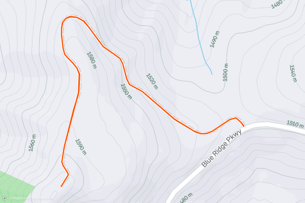
Fryingpan Mountain
Commissioned in 1941, the 70' tall fire tower on Fryingpan Mountain is the perfect destination for a short hike. The panoramic views from it's perch also make it the perfect spot to watch the sunrise or sunset....
18

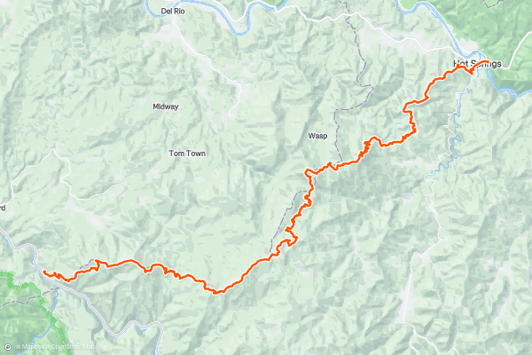
Appalachian Trail: Davenport Gap to Hot Springs
This portion of the Appalachian Trail is known for its summit of Max Patch Mountain, a key landmark that every thru-hiker places atop their list.
According to an article in "The Mountaineer," "this amazing area was cleared and used historically as a pasture for cattle and sheep back in the 1800's....
19


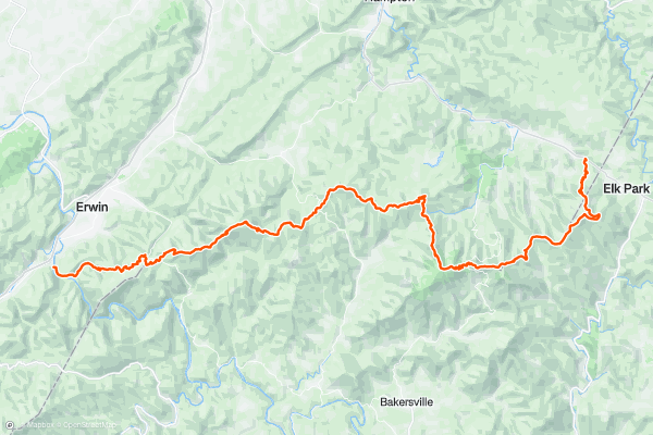
Appalachian Trail: Nolichucky River to Wilder Mine Hollow
Crossing the Nolichucky River, the white-blazed Appalachian Trail leads you into a beautiful section of trail. A relatively uneventful portion of trail will lead you through Indian Grave Gap before making its way into the Unaka Mountains....
20


Catawba Falls
Just a short drive from Asheville, this hike is an excellent opportunity to experience one of North Carolina's premier waterfalls. Most would consider the hike easy, though as you approach the base of the falls, off-camber rocks and roots may pose challenging obstacles to some....
Page 1 of 5
Top regions for hiking trails on Strava
- Acadia National Park
- Alabama
- Alaska
- Albuquerque
- Alyeska
- Angeles National Forest
- Arizona
- Arkansas
- Austin, TX
- Bay Area
- Bend
- Big Sky
- Blue Mountain Ski Area
- Boston
- Boulder, CO
- Brevard
- Bridger Bowl
- Buena Vista
- California
- Cape Cod
- Colorado
- Connecticut
- Dahlonega
- Downieville
- Ellijay
- Flagstaff
- Florida
- Georgia
- Glacier National Park (USA)
- Grand Teton National Park
- Great Smoky Mountains National Park, TN
- Hawaii
- Hurricane
- Hyalite
- Idaho
- Illinois
- Indiana
- Kansas
- Kentucky
- Lake Tahoe
- Las Vegas, NV
- Los Angeles, CA
- Maine
- Mammoth Mountain
- Marin County
- Maryland
- Massachusetts
- Maui, HI
- Michigan
- Minnesota
- Missouri
- Moab
- Montana
- Mount Rainier National Park
- Mt. Rainier National Park, WA
- Nederland
- Nevada
- New Hampshire
- New Jersey
- New Mexico
- New York
- New York, NY
- North Bridgers
- North Carolina
- North Dakota
- Oakridge
- Ohio
- Oklahoma
- Oregon
- Park City and Deer Valley
- Pennsylvania
- Phoenix, AZ
- Placitas
- Portland, OR
- Roanoke
- Salida
- Salt Lake City, UT
- San Diego, CA
- San Francisco, CA
- Santa Fe, NM
- Santa Monica Mountains
- Seattle, WA
- Sedona, AZ
- Sisters
- South Carolina
- South Dakota
- South Lake Tahoe, CA
- Stowe
- Sugarbush
- Sun Valley
- Taos
- Telluride
- Tennessee
- Texas
- Timberline Lodge Summer
- Utah
- Vermont
- Virginia
- Washington
- West Virginia
- Wind River Range
- Winter Park
- Wisconsin
- Wyoming
- Yellowstone National Park
- Yosemite National Park, CA
- Zion National Park, UT