
The Best Hiking Trails in Salida
Explore Hiking TrailsTop 19 hiking trails in Salida
1


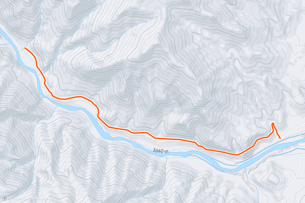
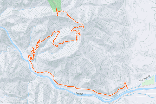
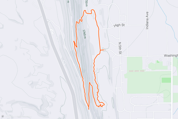
Tunnel Drive Trail
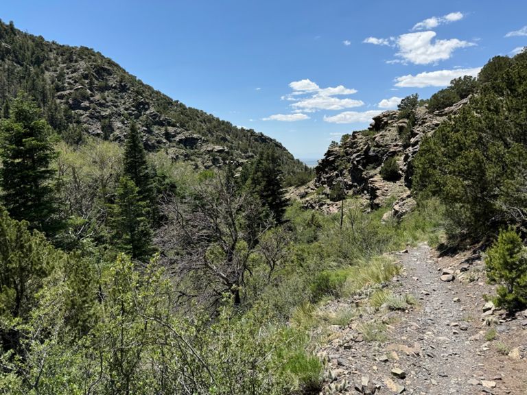
The Tunnel Drive Trail is an easy hike that provides an incredible effort-to-view ratio. This 4-mile round-trip jaunt follows a well-graded gravel trail the entire way. While you'll initially have to scale a short, steep climb to reach the old railroad grade, once on the railroad grade, it's a flat, beautiful hike back into the Royal Gorge....
2


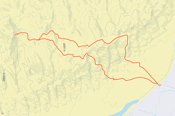
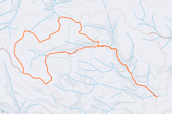
Graneros -> Greenhorn Loop
This short loop on the Graneros and Greenhorn Trails is quite easy and non-technical, but it still provides beautiful views and scenery from the lower Hogbacks area while being accessible directly from downtown Canon City!
The hike, as mapped, begins from the Greenhorn trailhead on the south end of the loop, but there are multiple trailheads located along the western edge of Canon City that provide easy access to this loop....
3


High Dune and Star Dune
Great Sand Dunes National Park and Preserve is famous for having the tallest dunes in North America, in a dunefield spanning 30 square miles. There are no trails in the dunefield-proper, meaning that hikers can go anywhere they desire....
4


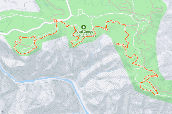
Royal Gorge Rim
The Arkansas River has carved a narrow gorge through the mountains near Canon City that’s now known as “The Royal Gorge.” Measuring 1,250 feet deep, the gorge is extremely narrow—only 50 feet wide at the bottom and 300 feet wide at the top....
5
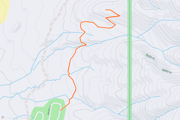
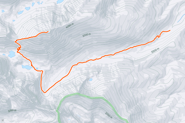
Medano Lake
The hike to Medano Lake is a straightforward stroll through the forest, but getting to the trailhead is at least half the adventure. It’s along the Medano Pass Primitive Road, a 4WD track from Great Sand Dunes National Park....
6


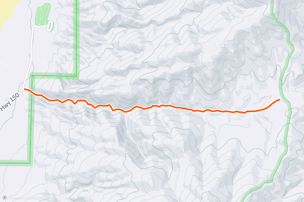
Mosca Pass Trail
For a quick trip out of the main park area and into more mountainous terrain, consider hiking the Mosca Pass Trail. It’s the only hiking trail that leads into the Sangre de Cristo Mountains from the paved park road....
7


Dunes Overlook Trail
The Dunes Overlook Trail is a somewhat hidden hike in Great Sand Dunes National Park. Most people hike on the dunes, but this trail is on the other side of the road, in the foothills with some tree cover....
8


Penitente Canyon
Penitente Canyon is best-known as a sport climbing hotspot. With routes ranging from easy to difficult, the rock climbing access here is easy and the canyon is simply stunning.
However, Penitente is quickly becoming known for a totally different aspect: it’s trail system....
9


Sand Creek Lakes
The Sand Creek Lakes sit high in the Sangre de Cristos, in alpine basins beneath 13,000-foot peaks. Though they’re within Great Sand Dunes National Park and Preserve, they feel a world away from the desert dunes, which lie in the valley thousands of feet below....
10


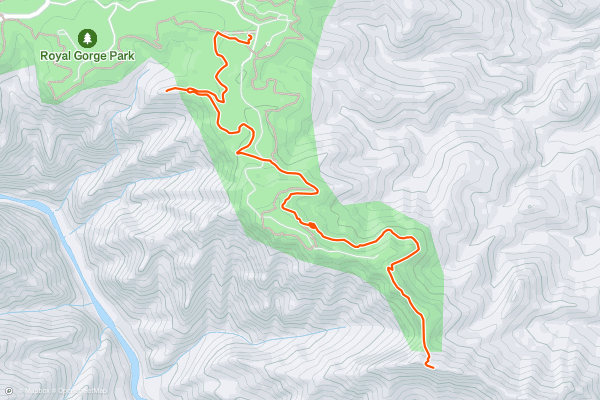
Fremont Peak from the Royal Gorge Park
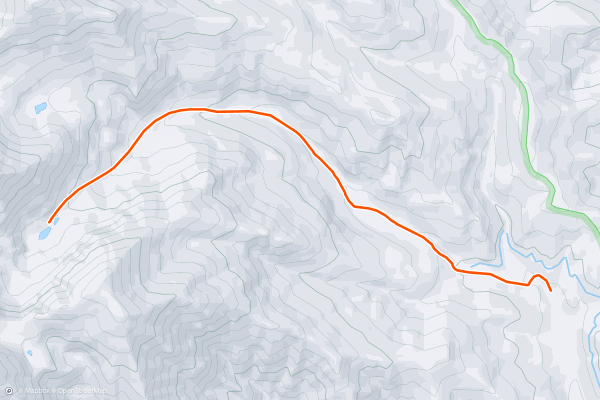
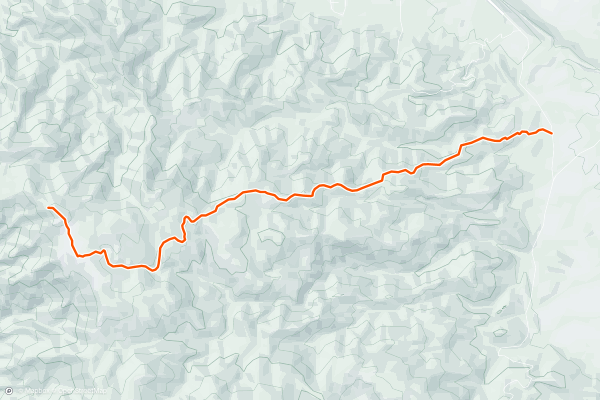
Fremont Peak rises to a height of 7,233 feet above sea level, towering over Canon City (5,331 feet) below. While this desert peak is of modest elevation compared to the nearby major mountain ranges, it does form the high point of a jagged ridge rising above the Royal Gorge, known as the Gorge Hills....
11

Fremont Peak from Tunnel Drive
Fremont Peak rises to a height of 7,233 feet above sea level, towering over Canon City (5,331 feet) below. While this desert peak is of modest elevation compared to the nearby major mountain ranges, it does form the high point of a jagged ridge rising above the Royal Gorge, known as the Gorge Hills....
12
Tanner Peak
Tanner Peak rises outside the town of Canon City to a height of 9,340 feet above sea level. This is one of the most prominent close-to-town peaks and is easily accessible from multiple aspects....
13

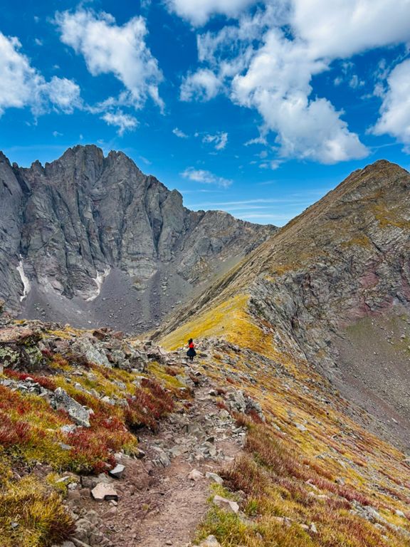


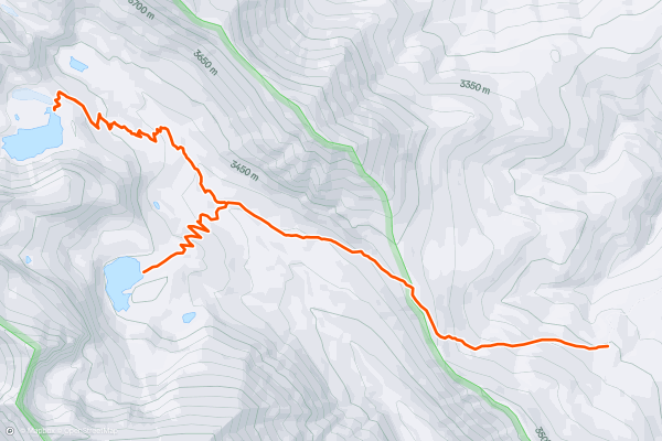
Humboldt Peak
The 14,000-foot peaks in the Sangre de Cristo Range are renowned for some of the most technical 14er climbing in the state of Colorado. In contrast to the more technical routes, Humboldt Peak only demands a Class 2 climb to access its 14,064-foot summit....
14
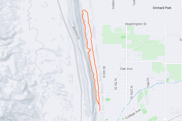
The Hogbacks
The singletrack in the Hogbacks area is easily accessible from the west side of Canon City, making these trails popular for local dog walkers, hikers, and trail runners looking to get a quick dose of nature....
15
Mount Herard from Medano Lake
Mount Herard (13,297 feet) is the summit that stands sentinel over the Great Sand Dunes. Thousands of visitors admire its snowy slopes from far below, but few ever think to venture there....
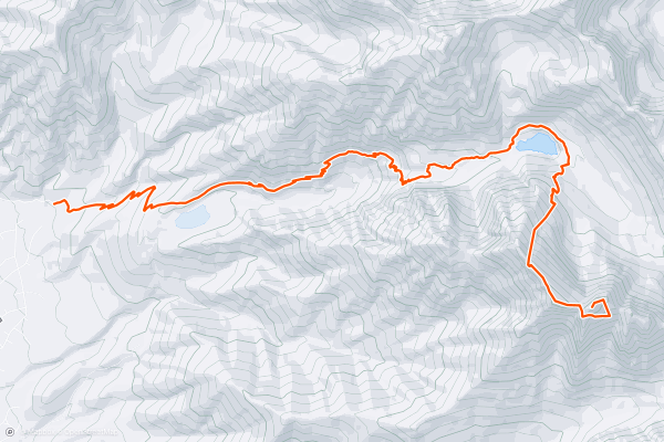
16


Marble Mountain from Music Pass
High in the Sangre de Cristos, the remote Sand Creek Valley is surrounded by several imposing peaks, all more than 13,000 feet in elevation. Of these, Marble Mountain (13,266 ft) has the most attainable summit....
17


Crestone Peak
*Note: this route warrants a "Moderate" Mountaineering difficulty rating.*
While Crestone Peak and Crestone Needle are renowned as two of the most beautiful, most formidable, and most technical 14ers in Colorado, if you stick to the standard routes, you can tackle each peak individually with a Class 3 climb....
18


Crestone Needle
*Note: this route warrants a "Moderate" Mountaineering difficulty rating.*
While Crestone Needle and Crestone Peak are renowned as two of the most beautiful, most formidable, and most technical 14ers in Colorado, if you stick to the standard routes, you can tackle each peak individually with a Class 3 climb....
19


Kit Carson and Challenger Point
*Note: this route warrants a "Moderate" Mountaineering difficulty rating.*
This is a great overnight backpacking trip into the high alpine of the Sangre De Cristo Mountains! Willow Lake, the halfway point of the climb, is surrounded by 200-foot cliffs with waterfalls and is the ideal spot to set up camp....
Top regions for hiking trails on Strava
- Acadia National Park
- Alabama
- Alaska
- Albuquerque
- Alyeska
- Angeles National Forest
- Arizona
- Arkansas
- Austin, TX
- Bay Area
- Bend
- Big Sky
- Blue Mountain Ski Area
- Boston
- Boulder, CO
- Brevard
- Bridger Bowl
- Buena Vista
- California
- Cape Cod
- Colorado
- Connecticut
- Dahlonega
- Downieville
- Ellijay
- Flagstaff
- Florida
- Georgia
- Glacier National Park (USA)
- Grand Teton National Park
- Great Smoky Mountains National Park, TN
- Hawaii
- Hurricane
- Hyalite
- Idaho
- Illinois
- Indiana
- Kansas
- Kentucky
- Lake Tahoe
- Las Vegas, NV
- Los Angeles, CA
- Maine
- Mammoth Mountain
- Marin County
- Maryland
- Massachusetts
- Maui, HI
- Michigan
- Minnesota
- Missouri
- Moab
- Montana
- Mount Rainier National Park
- Mt. Rainier National Park, WA
- Nederland
- Nevada
- New Hampshire
- New Jersey
- New Mexico
- New York
- New York, NY
- North Bridgers
- North Carolina
- North Dakota
- Oakridge
- Ohio
- Oklahoma
- Oregon
- Park City and Deer Valley
- Pennsylvania
- Phoenix, AZ
- Placitas
- Portland, OR
- Roanoke
- Salida
- Salt Lake City, UT
- San Diego, CA
- San Francisco, CA
- Santa Fe, NM
- Santa Monica Mountains
- Seattle, WA
- Sedona, AZ
- Sisters
- South Carolina
- South Dakota
- South Lake Tahoe, CA
- Stowe
- Sugarbush
- Sun Valley
- Taos
- Telluride
- Tennessee
- Texas
- Timberline Lodge Summer
- Utah
- Vermont
- Virginia
- Washington
- West Virginia
- Wind River Range
- Winter Park
- Wisconsin
- Wyoming
- Yellowstone National Park
- Yosemite National Park, CA
- Zion National Park, UT