
The Best Hiking Trails in Pennsylvania
Explore Hiking TrailsTop 32 hiking trails in Pennsylvania
Page 1 of 2
1
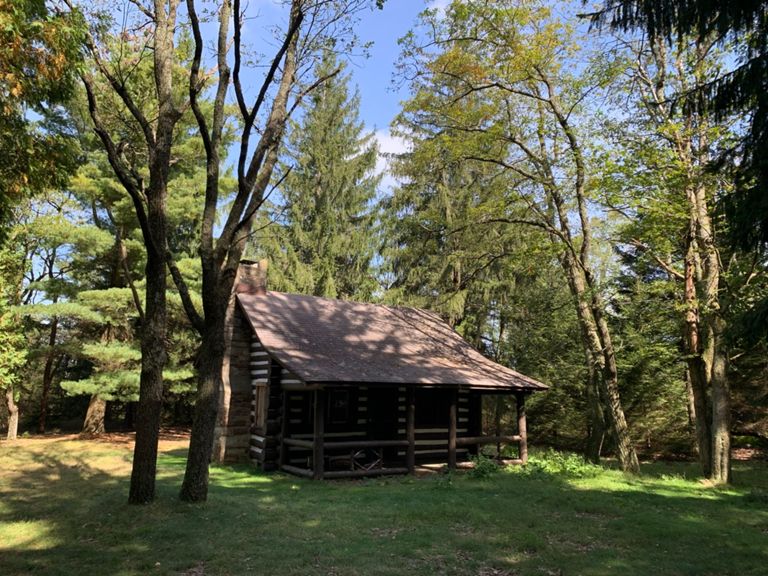


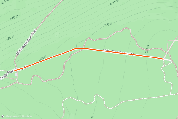
Little Flat Fire Tower
Hiking to Little Flat Fire Tower is one of the best easy hikes in Rothrock. A half-mile walk on a gated forest service road leads to one of the 4 maintained fire towers in the area, and though the steel structure is now closed to the public, it played an important role in fire prevention into the 1950s....
2


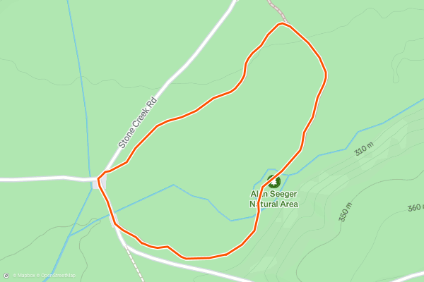
Alan Seeger Loop
Alan Seeger Natural Area is one of the best places to observe healthy, old-growth hemlock trees in central PA. A proposed *property-boundary* or *surveying* error by [this source](), the original forest was logged by the 1840s, leaving only a small selection of the beautiful evergreens behind....
3
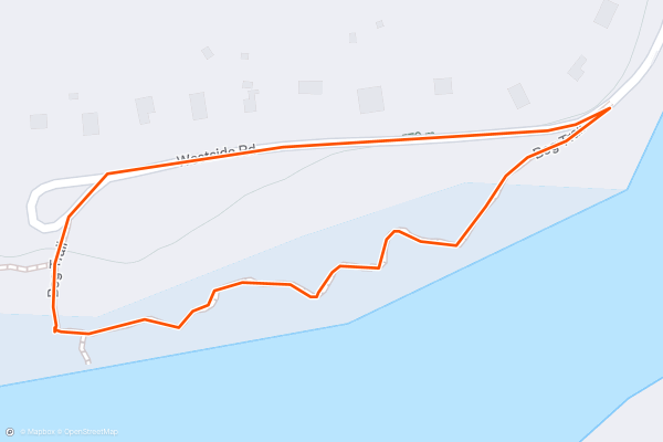
Black Moshannon Bog Trail
The Bog Trail offers a peaceful walk along a beautiful boardwalk on the edge of the Black Moshannon Lake. Considered the *largest reconstituted bog in Pennsylvania*, Black "Mo" is home to a unique selection of flora and fauna, including carnivorous plants, orchids, and other species you would expect to find further north....
4


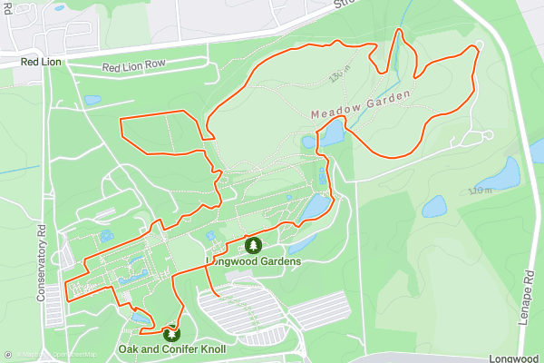
Longwood Gardens
The Longwood Gardens is a beautiful botanical garden in Pennsylvania that covers over 1,077 acres. While Longwood is most famous for its manicured grounds and the beautiful greenhouses filled with verdant plants, the grounds are also home to some wilder and more natural areas....
5


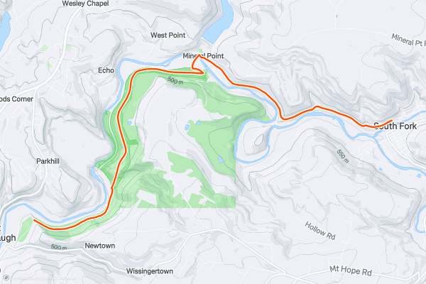
Path of the Flood Trail: Out-and-Back
The Path of the Flood Trail is a historic and scenic hike in Pennsylvania that follows the route of the devastating Johnstown Flood of 1889, which killed more than 2,200 people and destroyed much of the city....
6


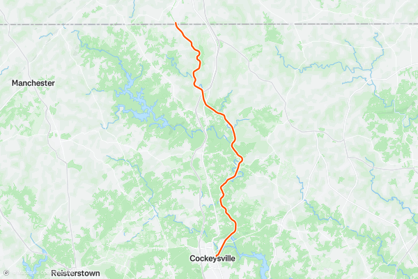
NCR TRail
The NCR Trail, also known as the Northern Central Railroad Trail and the Torrey C. Brown Trail, stretches 20 miles from Cockeysville to the Pennsylvania state line.
The trail follows the path of the former Northern Central Railway, which was a historic railroad line that operated in the 19th and early 20th centuries....
7


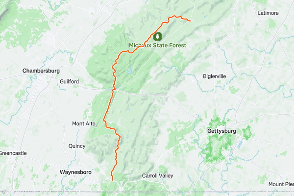
Appalachian Trail: Harpers Ferry to PA-16
Leaving Harpers Ferry, cross over the Potomac River to begin the 41-mile stretch of the AT through Maryland. Many thru-hikers or trail runners attempt to complete this stretch in one day, but the average hiker should allocate 3 to 4 days for this segment....
8


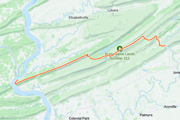
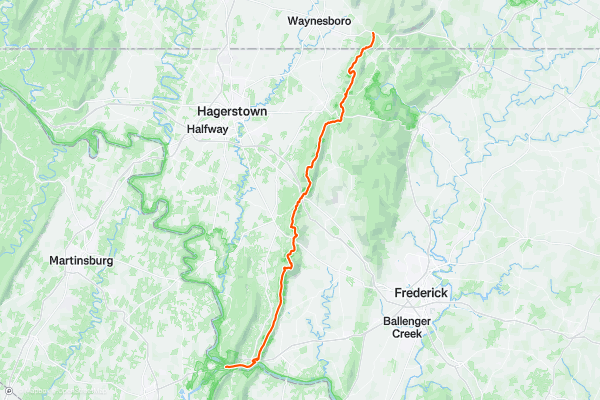
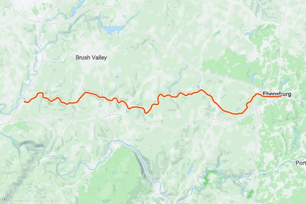
Appalachian Trail: Clark's Ferry to Swatara Gap
This segment of the Appalachian Trail showcases the long flattop ridges that define the Appalachian Mountains in Pennsylvania. Though this stretch is paralleled by farmlands and small towns in the valleys below, this stretch of trail is quite remote with no notable resupply points along the way....
9


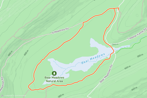
Bear Meadows Loop
This is by far one of the best hikes in Rothrock State Forest. Less than 30 minutes from downtown State College, this is a must-do for locals and travelers alike. The area, designated as a National Natural Landmark in 1965, provides a unique ecosystem atypical of the region....
10


Jackson Trail Loop
Located off PA-26 and just a short drive from downtown, this hike is an excellent introduction to the rugged, relentless rocks of Central Pennsylvania. Beginning across from Jo Hays Vista, the route traverses the Jackson Trail across a ridge, then returns via orange-blazed Mid State Trail....
11


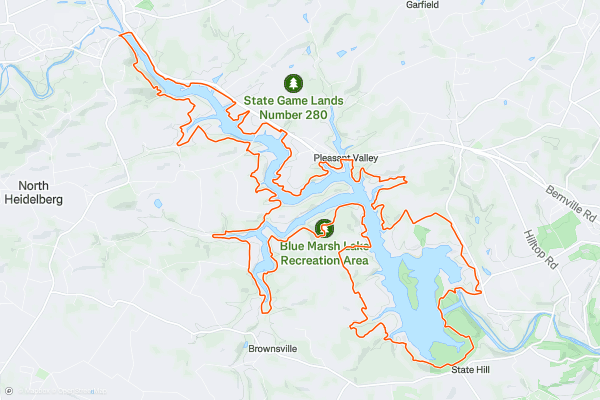
Blue Marsh Lake Border Trail
Located just outside of Reading, Blue Marsh Lake is a must-hike area and a great place to explore in the warmer months. The Lake Border Loop offers plenty of options for shorter day hikes and never ventures too far from the shore....
12


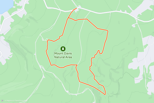
Mount Davis Loop
The 3,213-foot top of Mount Davis, the highest point in Pennsylvania, is easily-accessible by car and a short walk to a lookout tower. But for a longer hike in the area, tackle this loop instead....
13
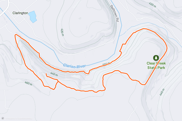
Rhododendron Loop
The so-called "Rhododendron Loop" in western Pennsylvania's Clear Creek State Park is so named because it's one of the best routes for experiencing the stunning beauty of the rhododendron forests hidden along the banks of the Clarion River....
14


Mount Nittany Blue Loop
Towering over State College and offering views towards Penn State, Mount Nittany is one of the best spots near town to go for a relaxing hike. Just shy of 5-miles, the blue-blazed loop (seen here) offers six defined viewpoints looking west towards campus, and south towards Tussey Mountain....
15


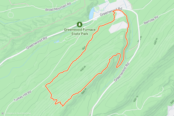
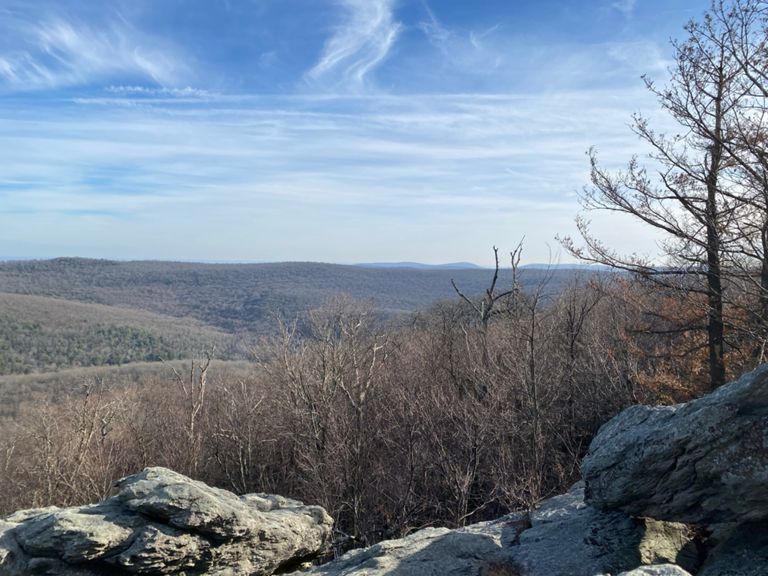
Stone Valley Vista Loop
Located near Greenwood Furnace State Park, and along the final few miles of the [Standing Stone Trail](https://fatmap.com/guidebooks/237/pennsylvania's-finest-hike-the-standing-stone-trail), Stone Valley Vista is one of the best overlooks in the area. It's an excellent day hike if you're visiting Greenwood Furnace, or a great day trip if you find yourself in the area....
16
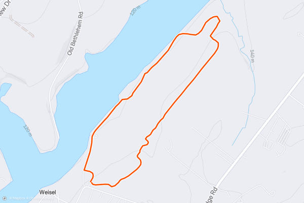
Elephant Trail
The Elephant Trail is an easy but popular hike in Nockamixon State Park. This beautiful state park is located on the shores of 1,450-acre Lake Nockamixon—a popular destination for boaters, fishers, and bird watchers....
17


Ghost Town Trail
This scenic trail follows the path of the former Ebensburg and Black Lick Railroad and the Cambria and Indiana Railroad, and combines natural beauty and historical significance. It was named for the numerous abandoned mining towns and remnants of the coal mining industry along its route....
18


Appalachian Trail: PA-16 to Pine Grove Furnace State Park
Arguably the toughest state on the Appalachian Trail, Pennsylvania is where shoes go to die. If you think that it gets easier the longer you're on the trail, this stretch will quickly put you in your place....
19


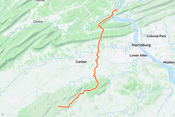
Appalachian Trail: Pine Grove Furnace State Park to Clark's Ferry
Home to the Appalachian Trail Museum, the historical and picturesque Pine Grove Furnace State Park serves as the southern terminus for this segment—also noted as the official halfway mark for the AT....
20


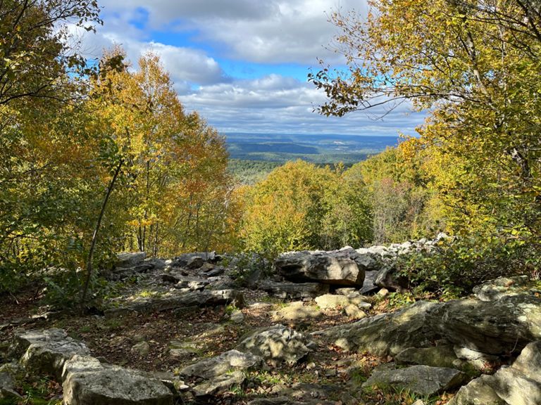
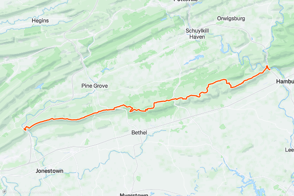
Appalachian Trail: Swatara Gap to Schuylkill Gap
Keeping its rhythm of flattop ridge traverses, the AT crosses I-81 as it traverses a peaceful—yet rocky—stretch though State Game Land 80. This stretch through "Rocksylvania" will push your focus to the limit as you traverse through fields of boulders....
Page 1 of 2
Top regions for hiking trails on Strava
- Acadia National Park
- Alabama
- Alaska
- Albuquerque
- Alyeska
- Angeles National Forest
- Arizona
- Arkansas
- Austin, TX
- Bay Area
- Bend
- Big Sky
- Blue Mountain Ski Area
- Boston
- Boulder, CO
- Brevard
- Bridger Bowl
- Buena Vista
- California
- Cape Cod
- Colorado
- Connecticut
- Dahlonega
- Downieville
- Ellijay
- Flagstaff
- Florida
- Georgia
- Glacier National Park (USA)
- Grand Teton National Park
- Great Smoky Mountains National Park, TN
- Hawaii
- Hurricane
- Hyalite
- Idaho
- Illinois
- Indiana
- Kansas
- Kentucky
- Lake Tahoe
- Las Vegas, NV
- Los Angeles, CA
- Maine
- Mammoth Mountain
- Marin County
- Maryland
- Massachusetts
- Maui, HI
- Michigan
- Minnesota
- Missouri
- Moab
- Montana
- Mount Rainier National Park
- Mt. Rainier National Park, WA
- Nederland
- Nevada
- New Hampshire
- New Jersey
- New Mexico
- New York
- New York, NY
- North Bridgers
- North Carolina
- North Dakota
- Oakridge
- Ohio
- Oklahoma
- Oregon
- Park City and Deer Valley
- Pennsylvania
- Phoenix, AZ
- Placitas
- Portland, OR
- Roanoke
- Salida
- Salt Lake City, UT
- San Diego, CA
- San Francisco, CA
- Santa Fe, NM
- Santa Monica Mountains
- Seattle, WA
- Sedona, AZ
- Sisters
- South Carolina
- South Dakota
- South Lake Tahoe, CA
- Stowe
- Sugarbush
- Sun Valley
- Taos
- Telluride
- Tennessee
- Texas
- Timberline Lodge Summer
- Utah
- Vermont
- Virginia
- Washington
- West Virginia
- Wind River Range
- Winter Park
- Wisconsin
- Wyoming
- Yellowstone National Park
- Yosemite National Park, CA
- Zion National Park, UT