
The Best Hiking Trails in Washington
Explore Hiking TrailsTop 121 hiking trails in Washington
Page 1 of 7
1


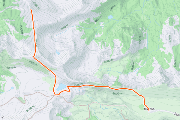
Mount Fremont Lookout Trail
Take in views of Mount Rainier from the deck of a historic fire lookout. The Mount Fremont Lookout Trail takes you from the Sunrise Visitor Center to the Mount Fremont Fire Lookout, which was built by the National Park Service in 1933. The hike begins on the Sourdough Ridge trail. After about a mile and a half, you’ll turn right onto the Mount Fremont Lookout Trail and make your way to the lookout. The inside of the building is closed to the public, but it may be possible to climb the steps up to the deck. This trail follows an out and back route. Because of the high elevation and steep grades, most hikers consider this a hard trail. This is one of the most popular hikes for Strava members visiting Mount Rainier National Park.
2


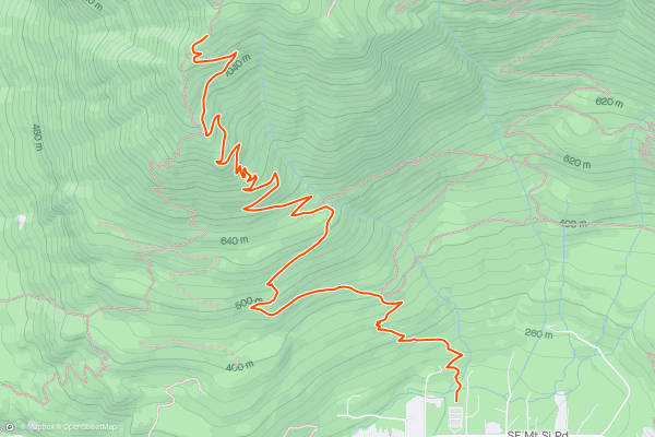
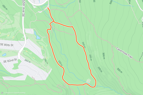
Cable Like Trail to West Tiger #3
The Cable Line Trail to the summit of West Tiger #3 is a popular and challenging hike just a few miles west of Issaquah. Tiger mountain has 4 peaks, one to the east, then a cluster of 3 on the western side of the park. Locals call this peak T-3. The hike follows an out and back route. It’s steep the whole way, and most consider this a hard trail. “T-3” is one of the most popular hikes among Strava members in the Seattle Area. The views from the top are well worth the effort to get there!
3


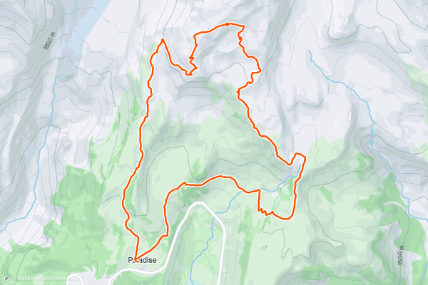
The Skyline Trail
The Skyline Trail Loop has it all: glacier views, waterfalls, stunning valleys. It’s hard to imagine more beauty packed into a single hike. The trail begins at the Jackson Visitor Center. Most hikers proceed counterclockwise, but the clockwise route is also spectacular. Because of its length and total elevation gain, most hikers consider this a hard hike. The Skyline Trail Loop is one of the most popular hikes for Strava members visiting Mount Rainier National Park.
4


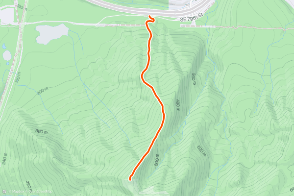
Mount Si Trail
The Mount Si Trail is an epic day hike that takes you to just beneath the summit of Mount Si. The first half of the route winds through old growth forest then opens up to spectacular views of the surrounding area with Mt. Rainier to the south. If you’d like to reach the true summit, you can venture on another half mile up the Mt. Si Haystack Scramble. This adds to the challenge and adventure. The Mount Si Trail is one of the most hiked trails in the state and is extremely popular with local Strava members.
5


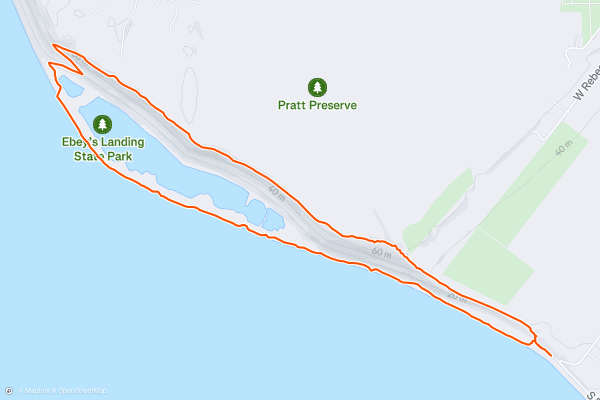
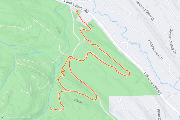
Ebey's Landing
If you’re looking for a mellow hike, it doesn’t get much easier than this! This quick loop through Ebey’s Landing State Park traverses the top of a bluff overlooking the water and then returns directly along the shore....
6


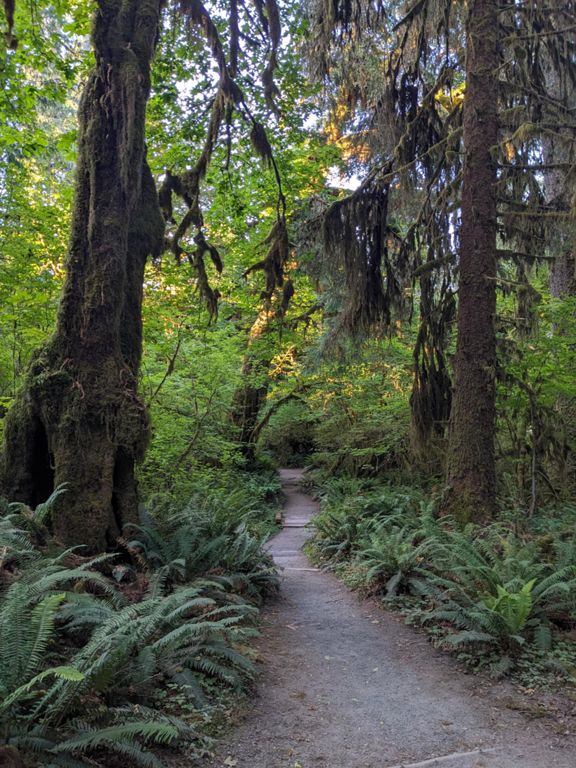

Hall of Mosses Trail
This short hike affords enchanting scenery deep beneath the canopy of the rainforest, with massive screens of moss hanging from the towering trees. On this quick loop, you’ll enjoy "educational signage and plenty of opportunity to explore some of Washington's gorgeous, lush rainforests,” according to [WTA....
7


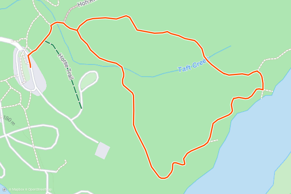
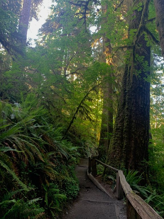
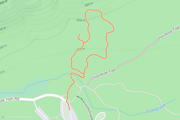
Hoh Rain Forest Loop
This short hike affords enchanting scenery deep beneath the canopy of the rain forest. The deep, lush forest covered in moss is a result of the incredible 140 inches of precipitation that the Hoh Rain Forest receives every year....
8


Olympic Hot Springs Trail
These natural hot springs are tucked in the fragrant evergreen forest of the Elwha River Valley. They require only a little bit of work to reach, in the form of a drive into Olympic National Park and a hike into a wilderness area....
9


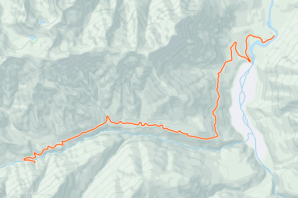
PCT: High Bridge to Rainy Pass
The PCT enters North Cascades National Park near High Bridge in the Stehekin Valley, then goes northward about 18 miles through the national park. Beyond the park bounds, there remain a few more miles to a highway at Rainy Pass....
10


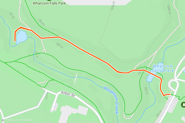
Whatcom Falls
To reach Whatcom Falls, you'll walk directly from the trailhead and descend a paved path to reach the stone bridge that crosses the stream. From the vaulted bridge, you'll enjoy a jaw-dropping view of the thundering falls just upstream....
11

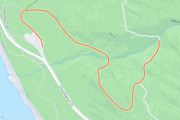
Lookout Mountain Forest Preserve: Waterfall Trail
Lookout Mountain Forest Preserve is home to a fantastic hike that serves up two different 12-foot waterfalls along Austin Creek. The route mapped here runs 2.6 miles round-trip and is focused on the two waterfalls, but there's more than 6 miles of trails in the preserve....
12


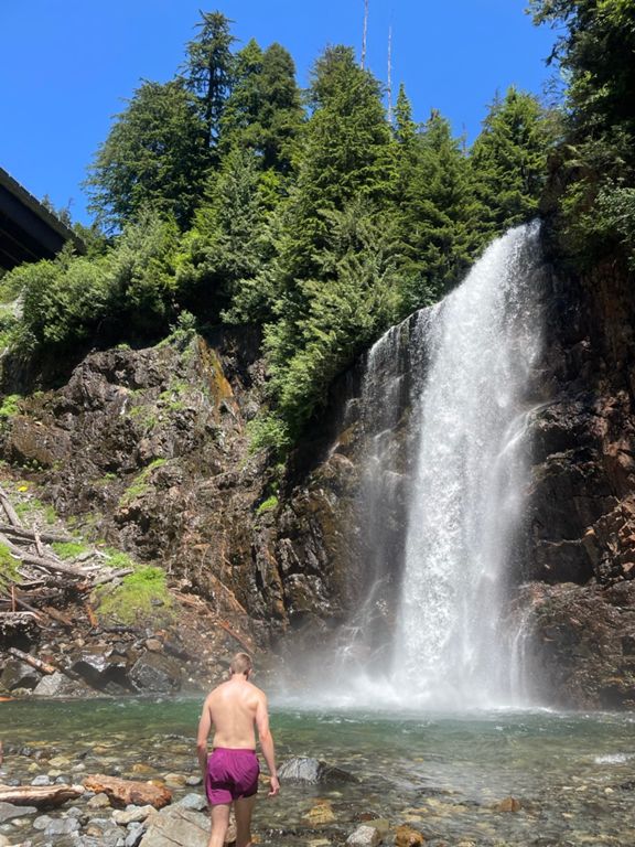
Fern Falls
This waterfall doesn't appear on many maps, but according to some sources, it's called "Fern Falls." The lack of renown is probably due to the access. In order to hike to Fern Falls, you'll essentially have to walk up a gated forest road....
13


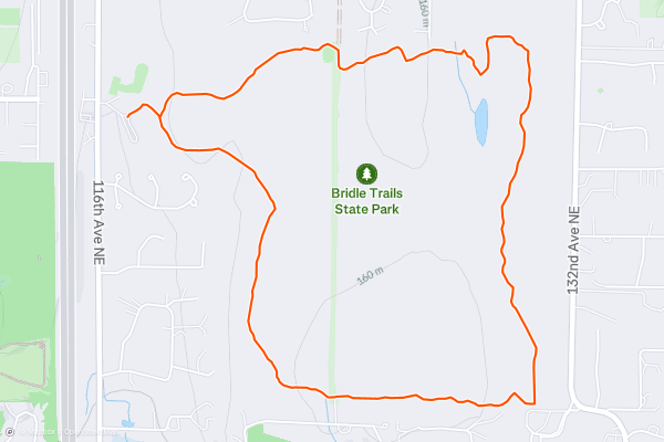
Bridle Trails State Park: Coyote Loop Trail
Bridle Trails State Park is conveniently located between Kirkland and Redmond in the Seattle metro area. While the state park's name derives from its popularity with equestrians, this 489-acre park is also a fantastic hiking and trail running destination within minutes of downtown Seattle....
14


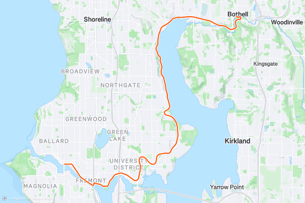
Burke-Gilman Trail
The Burke-Gilman Trail is a lengthy paved greenway trail running through the Seattle metro area. This trail is extremely popular with road cyclists (both recreationally and for commuting), but walkers/hikers, runners, skaters, and more all use this trail....
15


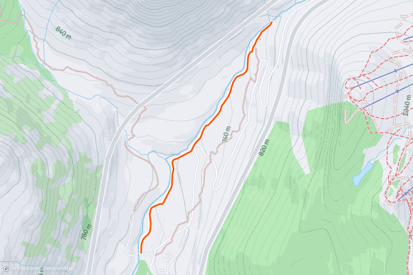
Franklin Falls
At just 2 miles and 360 vertical feet, this hike might be quite short, but what it lacks in distance it makes up for in stunning beauty! The end goal of this hike is the stunning Franklin Falls, which measures a whopping 135 feet of vertical drop in three separate tiers....
16


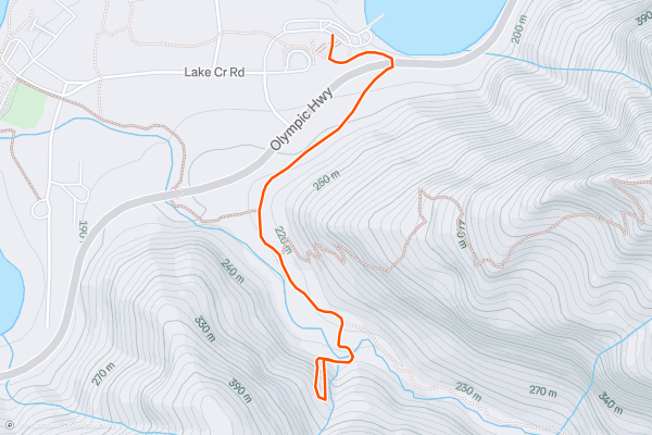
Marymere Falls
Marymere Falls is a gorgeous 90-foot-tall waterfall that's renowned as one of the most beautiful in Olympic National Park. The hike to reach the falls is just as spectacular: you'll have the opportunity to hike through a lush moss-covered old-growth forest of towering conifers and maples on this almost 2-mile round-trip hike....
17


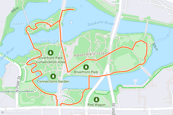
Riverfront Park
There aren't many simpler hikes out there than this one - it follows a clear, smooth path and is surrounded by landmarks, making it almost impossible to get lost! The stroll can be started from just about anywhere surrounding it, and there are plenty of variations should you want to explore a little....
18


Red Town Trail
With a maze of perfectly built trails, the area around Cougar Mountain is one of the best hiking spots near Seattle. All of the trails are excellent, but the Red Town Trail is arguably the most famous of the lot, and hiking it is a great way to start exploring the area....
19
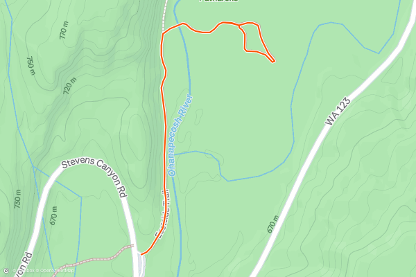
Grove of the Patriarchs
The Grove of the Patriarchs is the best spot in Mount Rainier National Park to see giant trees. This short, easy hike quickly drops into a grove of ancient trees that soar hundreds of feet into the air....
20


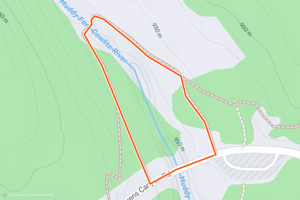
Box Canyon
At just 0.3 miles, many hikers might skip over this short paved loop to Box Canyon. That would be a mistake, though, because this quick roadside stop in Mount Rainier National Park is absolutely jaw-dropping!
"Box Canyon is a narrow slot canyon carved by the Muddy Fork of the Cowlitz River," writes the [NPS](https://www....
Page 1 of 7
Top regions for hiking trails on Strava
- Acadia National Park
- Alabama
- Alaska
- Albuquerque
- Alyeska
- Angeles National Forest
- Arizona
- Arkansas
- Austin, TX
- Bay Area
- Bend
- Big Sky
- Blue Mountain Ski Area
- Boston
- Boulder, CO
- Brevard
- Bridger Bowl
- Buena Vista
- California
- Cape Cod
- Colorado
- Connecticut
- Dahlonega
- Downieville
- Ellijay
- Flagstaff
- Florida
- Georgia
- Glacier National Park (USA)
- Grand Teton National Park
- Great Smoky Mountains National Park, TN
- Hawaii
- Hurricane
- Hyalite
- Idaho
- Illinois
- Indiana
- Kansas
- Kentucky
- Lake Tahoe
- Las Vegas, NV
- Los Angeles, CA
- Maine
- Mammoth Mountain
- Marin County
- Maryland
- Massachusetts
- Maui, HI
- Michigan
- Minnesota
- Missouri
- Moab
- Montana
- Mount Rainier National Park
- Mt. Rainier National Park, WA
- Nederland
- Nevada
- New Hampshire
- New Jersey
- New Mexico
- New York
- New York, NY
- North Bridgers
- North Carolina
- North Dakota
- Oakridge
- Ohio
- Oklahoma
- Oregon
- Park City and Deer Valley
- Pennsylvania
- Phoenix, AZ
- Placitas
- Portland, OR
- Roanoke
- Salida
- Salt Lake City, UT
- San Diego, CA
- San Francisco, CA
- Santa Fe, NM
- Santa Monica Mountains
- Seattle, WA
- Sedona, AZ
- Sisters
- South Carolina
- South Dakota
- South Lake Tahoe, CA
- Stowe
- Sugarbush
- Sun Valley
- Taos
- Telluride
- Tennessee
- Texas
- Timberline Lodge Summer
- Utah
- Vermont
- Virginia
- Washington
- West Virginia
- Wind River Range
- Winter Park
- Wisconsin
- Wyoming
- Yellowstone National Park
- Yosemite National Park, CA
- Zion National Park, UT